Projects, files and cloud
Road Mesh is local-first. Your work lives in project files you control; signing in adds cloud convenience on top without changing that. This chapter covers files, settings, exports and the optional cloud features.
Project files
A project is a single .tsim.json file containing the raw imported data, the editable network, every scenario's demand and closures (and its own network copy where a scenario has diverged from the baseline), projection and your saved view. In browsers with file-system access Road Mesh saves in place; elsewhere it falls back to downloads. Project files carry a schema version, and older files are migrated automatically when opened — a project saved months ago opens cleanly today.
The workspace guards your work: navigating away with unsaved changes prompts first, and if something goes wrong the workspace offers to preserve the current project before reloading.
Settings
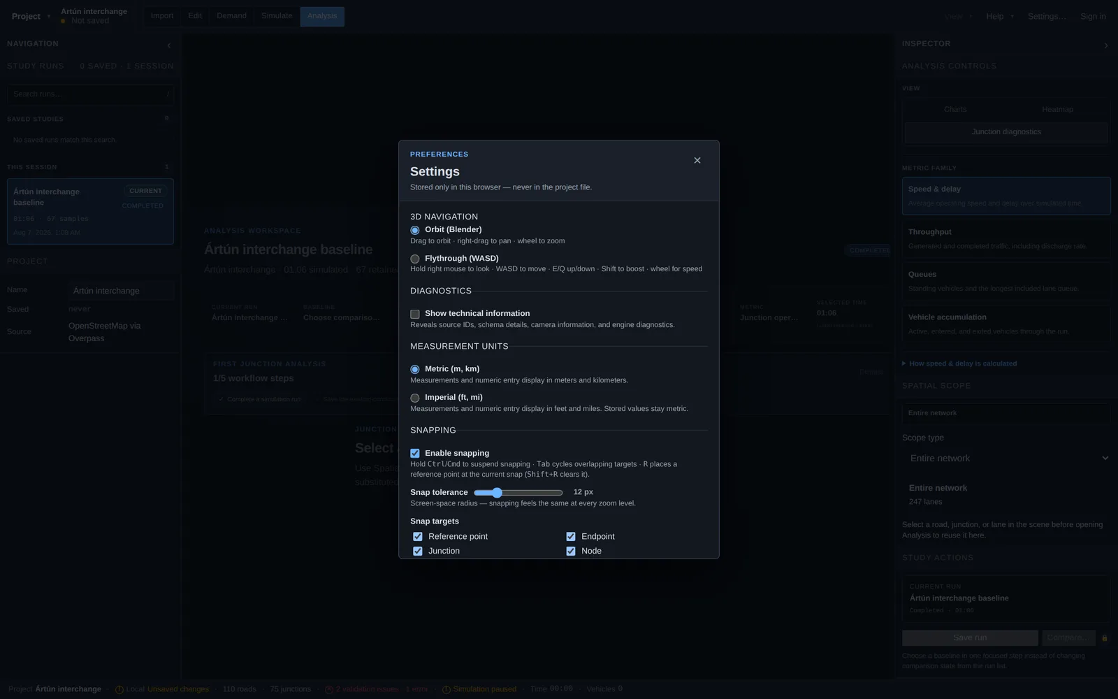
The Settings dialog holds browser-level preferences — they apply to you, not to the project file:
- 3D navigation — Orbit (drag to orbit, right-drag to pan, wheel to zoom) or first-person Flythrough (WASD).
- Measurement units — metric or imperial display; stored values stay metric.
- Diagnostics — a technical-information toggle that reveals source IDs, schema details and engine diagnostics.
- Snapping — enable/disable, screen-space tolerance, and which targets (reference points, endpoints, junctions, nodes) attract the cursor.
- Import — show the import-area shape picker, which adds the Rectangle / Circle switch to the Import panel.
Exports
Beyond project files, the Project menu can export a viewport image (in Edit, Demand and Simulate modes) and export the road network as GIS layers (GeoJSON or GeoPackage). Simulation results export as CSV or JSON from Simulate and Analysis on paid plans.
Cloud projects, versions and sharing
Signing in (email-based, with a “continue without an account” option always present) unlocks the cloud side: save projects to the cloud, browse them in the projects dashboard, and keep them synced automatically while you work. Cloud projects keep version history you can restore from, and can be shared with teammates; organizations manage seats and plans centrally.
Plans and pricing — including import-area limits, GIS/CAD import, live traffic data and counter history — are described on the pricing page; the free tier keeps the full local file-based workflow.